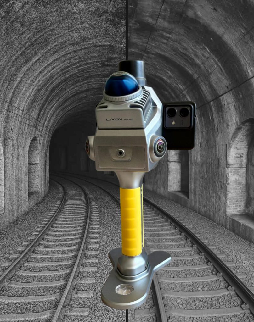
L-40 Handy SLAM
Handheld SLAM-based 3D laser scanner for precision surveying and real-time visualization.
Uses Livox LiDAR technology and advanced SLAM algorithms to capture up to about 200,000 points per second.
Provides a point cloud measurement range of roughly 40 m (about 80 m diameter) for detailed indoor and outdoor 3D models.
Mechanical global-shutter imaging avoids rolling-shutter artefacts and improves colour accuracy in the generated point clouds.
Dual 1″ 16 MP CMOS sensors (pixel size around 2.4 μm) deliver high-resolution imagery and accurate colour information.
Designed for efficient one-click export and integration of point cloud data, suitable for BIM and as‑built documentation workflows.
Delivered with a dedicated Android mobile app (TopoGEOS Capture) to control scanning, monitor live point clouds and manage data from the field.